I have so much to tell you about my one-month travel along the eastern coast of the main island of Madagascar archipelago. On my way, I paused for a while on a beautiful beach of the Ampitabe lake, in order to gather my thoughts and to carve my pictures and my words.

Departing Tamatave (Taomasina) – the country’s main seaport, I endeavoured first a one-week travel in the Canal des Panganales area. The Canal des Panganales refers to a chain of lakes, ponds, lagoons, swamps and waterways bordering the Indian Ocean from Tamatave to Farafangana located about 650 km further south.
Madagascar’s eastern shore counts many rivers and tributaries feeding a variety of large lakes and ponds, and many inland rivers connecting with the Indian Ocean. This topography hinders the construction of coastal roads. Moreover, maritime routes following the main island’s coast are perilous, owing to treacherous reefs and strong streams. In brief, this area is poorly connected to outer world.
The Canal des Panganales
The Creator interconnected the numerous lakes, lagoons and waterways of the Canal des Panagales only partially.
Various man-made canal sections completed the natural waterways starting from the late 19th century. The Canal des Panganales aimed to compensate the lack of road network in the coastal region and to provide a safer alternative to the coastal navigation on the Indian Ocean. It facilitated the local trade along the coast in order to boost exports from the French colony and mainland France. In addition, the French built the seaport of Tamatave, as well as a railway line along the eastern coast.
The first two sections of the Canal Panganales connecting Tamatave and Vatomandry (155 km) were built by the French general Gallieni between 1897 and 1904. The heavy infrastructural work relied on local forced labour, complemented by 6.000 Chinese coolies. It costed many workers’ lives owing to tropical diseases, crocodiles and labour hazards. Some historical legacies
In the 1950’s, the first two sections of the Canal des Panganales were enlarged and extended until Farafangana. Upon completion of the project, the Canal ran effectively over 650 km, although not for a long time period. Owing to invading sand and vegetation, the waterway became gradually less suitable for boat transit and heavy good transportation. Consequently, the Canal des Panganales slipped slowly into decay over the next decades.

Nowadays, about half of the Panganales Canal remains navigable for light embarkations only – between Tamatave and Vatomandry (155 km) as well as between Mahanoro and Mananjary (205 km).
Waterway
Today, the Canal des Pangalanes remains vital for local communities which rely on the waterway for their mutual interactions as well as for their connections with the coastal main cities of Tamatave and Brickaville. Ferries run up and down navigable areas transporting people, as well as sand, wood, charcoal, dried fish and other local products to the main markets. Conversely, manufactured goods and some food items travel the other way round to serve local communities.
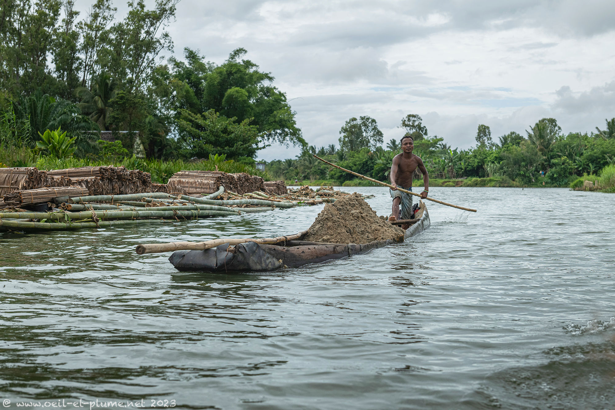


A dense and effective system of commercial exchanges runs smoothly thanks to the boat traffic on the Canal. Local producers rely on boat drivers to ship their goods to retailers in the main cities’ markets, and to receive the financial income of the sales. Parcels, letters and money are delivered along the waterway based on trust and reputation.
Fishing ground
Food agriculture in the region is not much developed because of sandy nature of the soil, not to mention the salinity of the water available close to the Indian Ocean. Food resources stem essentially from the water.
In addition, the Canal des Panganales provides food for the locals, who use a combination of fish barricades and traps to catch fresh water fish for their daily consumption. Creels are immersed for a couple of hours and emptied at least once daily.


Railway line
The thin coastal land portion leaves some space to a railway lane. Nowadays, it is used mostly for heavy good transportation. Passengers’ transportation is more anecdotal, and subject to a capricious timetable. Trains are rare enough that locals use the railway track to sit and to stroll. I did not see any functional train station, while the ones built by the French colonial administration are left to decay.


Local life
I love visiting local communities and observing their daily life which entails so much raw beauty. Their culture fuses animism and christianity. Every village has its sacred place where animists rites are still practiced.


The sacred location was made so based on an initial sacrifice of a cow (zebu) to please and to honor the dead and to obtain their protection. In the heart of the village, a large tree is often the ceiling of the community’s open-air meeting hall. In the outskirts of the settlement, a christian cemetery might host the remains of people coming from afar including China.
The daily life of locals is mostly about work, but not only. There are always moments for relaxing and playing games. During my visit, the lichee collection was ongoing, which prompted children to play fanorona with lichee stones. In turn, adult players sticked to usual tabletop games such as dominos.


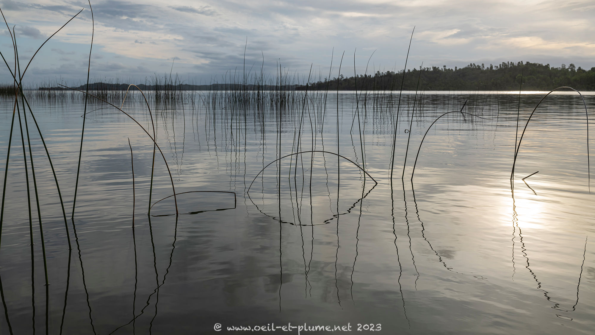
Worth recalling here that the Canal des Panganales is made also of large fresh water lakes. I loved the days spent on their shores which look like unspoiled sea beaches.


Despite the awesome Panganales landscapes, tourism struggles to develop. I was the sole visitor at the three hotel facilities where I stayed during the week. Never mind, I enjoyed the experience in full.
To continue here.
Cheers,
